The job at the International School was advertised in the January of 2009, and after two interviews, I was appointed two months later. I would taking over from Richard Allaway of geographyalltheway fame at a laptop school, and teaching International Baccalaureate (IB) having never previously taught KS5! This seemed like a big deal, never mind the move to France, taking a significant hit on the sale of our house in the UK and the packing up and leaving my home country perhaps for ever. On the plus side, I spoke some of the lingo having been together with Gaelle, my French wife since late last century.
I was lucky enough to be brought up in the geographical haven that is North Wales, and spent most of my youth walking in the Carneddau, canoeing around the coastline of the Llŷn Peninsula and mountain biking in the Gwydyr Forest. After my subsequent travels around the world, I maintain that North Wales is the most beautiful place I’ve ever been to, and while many children perhaps don’t fully appreciate where they live, I certainly did. Even when other social distractions surfaced around A-Level time (Llandudno’s Broadway Boulevard), I still spent as much time as possible out and about.
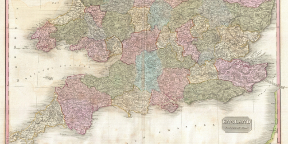
So here it goes. This is my first attempt at writing a blog entry and I am not sure how good it will be, however, I can probably guarantee that it will be better than the average person’s location knowledge of the UK. The number of times I have been speaking to someone living in London and they talk about the fact that they are going ‘down to Newcastle’ or vice versa is enough to drive a Geography teacher mad.
Maps are objects of fetish; there is something special about tracing a route across the London Underground map or blowing the dust off maps that chart countries which don’t even exist anymore. The thrill of places we have never been, or the familiarity of home, all appeal, and can be imagined through the medium of maps. It is no coincidence that with the power to look at almost the whole (can’t find out exactly how much!?) of the globe, the first search the people do in Google Earth is to look at their house. In the classroom, maps can intrigue learners, and be used to add context and depth to learning across the curriculum. Long the reserve of Geography departments, maps that you can access with technology are a cost-effective way to bring the real world into the classroom - giving extended meaning to many subject disciplines.
Last December, we took 8 of my Year 6 children on an extraordinary school trip! Armed with our GoPro camera, a GPS tracker, a polystyrene protective case designed by our caretaker, a large weather balloon, 2 canisters of helium and our brave Lego stuntman (the children named him Bob), we set off to find a suitable launch area.
Rather than tell you about what happened next, here is some writing from the children's recounts. I've also included an iMovie trailer that two of the girls made based on the footage they captured during the two days (other trailers can be found on my youtube channel - http://www.youtube.com/user/linakerict).
Now it's over to the children...
This is a ‘how to’ post that was inspired by this post over at Noel Jenkins’ excellent Digital Geography. This in turn led me to another useful and creative blog by Paul Bogush and this post on creating RSA Style animation videos with the class. If you want to know how to do it properly, I recommend that you head over to Noel and Paul’s posts first.
This post is the story of how a class of Year 10 Geography students got on with the challenge. Before I start, it’s worth looking at how the experts do it:
During the development unit, I wanted time to really explore the idea of the factors that affect the economic development of countries. In particular, I’ve always struggled to get students to link these factors together. After some of the more traditional lessons, I decided to give this a try. In the end, it took 3 ‘double lessons’, so 6 hours in total.
With the advances in technology hitting our classrooms on such a regular basis, we sometimes forget that the old ways are sometimes the best ways. You can have all the technology in the world, but sometimes being creative with what you've got can be a lot more powerful.
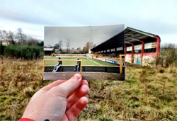
I stumbled across a fantastically creative, but amazingly simple, website a few months ago called Dear Photograph. Although the website is not intended to be an educational tool, with a bit of creative thinking, you'll find that the idea can be used to promote learning across a range of subjects.

A community-driven platform for showcasing the latest innovations and voices in schools
Pioneer House
North Road
Ellesmere Port
CH65 1AD
United Kingdom